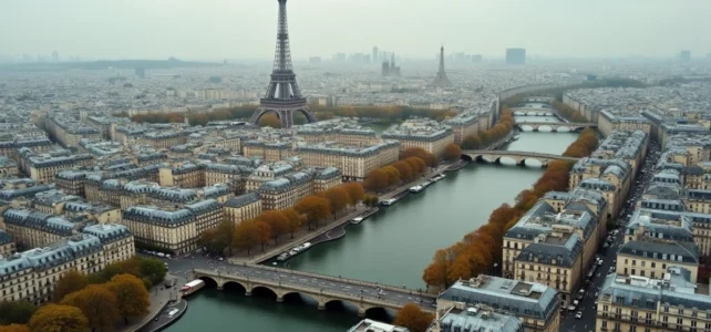
Paris lends itself to dozens of high viewpoints, from the terraces of monuments to the balconies of department stores. Articles on the subject often list the same spots: Eiffel Tower, Arc de Triomphe, Sacré-Cœur. But the aerial view of the capital is no longer limited to physical belvederes. From digitized photographic archives to 3D flyover tools, new ways to observe Paris from the sky have developed in recent years.
Aerial Archives of Paris: Thousands of Unknown Photos Available for Free
The ECPAD (Establishment for Communication and Audiovisual Production of Defense) has made available online in 2023 2,750 aerial views of Paris on the ImagesDéfense platform. These photographs, taken between 1969 and 2001, cover several decades of urban transformation.
Their uniqueness lies in the angle of capture: a diagonal angle that makes the relief of the buildings readable, unlike the classic vertical views of cadastres or Google Maps. Rooftops, inner courtyards, and ongoing construction sites from a given time can be distinguished.
This collection allows for a visual comparison of the Parisian landscape over more than thirty years. The surroundings of Montparnasse before and after the construction of the tower, the Halles district at different phases of redevelopment, the banks of the Seine before their partial pedestrianization.
These are documented sequences that the usual tourist panoramas do not show. For those wishing to consult Paris viewed from an airplane online, this type of resource provides a historical depth that simple contemplation from a rooftop cannot offer.

Digital Flyover of Paris: France Vue and 3D Tools from IGN
The National Institute of Geographic and Forest Information (IGN) offers the France Vue application, which allows users to fly over Paris in three dimensions. The tool combines recent aerial photos, relief data, and LiDAR point clouds.
The announced accuracy for measuring heights and distances is around 10 cm. In practical terms, one can measure the height of a Haussmannian building, evaluate the distance between two monuments, or observe the canopy of Parisian parks with a level of detail that public satellite navigation does not reach.
The interest goes beyond mere leisure. Urban planners, architects, and heritage preservation associations use this data to document the evolution of built environments. For the general public, the experience is akin to a helicopter flyover, without the regulatory constraints related to flying over dense urban areas.
Live Panoramic Webcams
The SkylineWebcams platform continuously broadcasts a view of the Eiffel Tower, Sacré-Cœur, and La Défense. This free video stream offers a real-time aerial view of Paris, accessible from any screen. The fixed angle limits exploration, but the live capture provides access to variations in light, weather, and events visible on a city-wide scale (fireworks on July 14, for example).
Drone Regulations in Paris: Why Flyovers are Highly Regulated
The temptation to produce one’s own aerial views of Paris with a drone faces a strict regulatory framework. Flying drones over Paris intra-muros is prohibited unless a prefectural exemption is granted, due to its classification as a reinforced protection zone.
This restriction covers almost the entire capital and part of the inner suburbs. Exemptions are granted on a case-by-case basis, primarily for professional audiovisual productions, public safety missions, or technical surveys regulated by the DGAC (General Directorate of Civil Aviation).
- Leisure flights with drones are prohibited throughout Paris intra-muros, including in public parks and gardens.
- Professionals must obtain a specific prefectural authorization, with a processing time of several weeks.
- Violators face criminal penalties, as unauthorized flights over restricted areas constitute an offense under the transport code.
This reality explains why professional aerial views of Paris most often come from production companies with the necessary permits, or from shots taken from manned aircraft (helicopters, ultralights) operating in defined corridors.
Aerial Views of Paris from a Manned Flight: Hot Air Balloon and Helicopter
For those who want a physical flyover experience, there are two main options in Île-de-France.
Hot air balloon flights in Île-de-France take off from peripheral sites (Fontainebleau, the Chevreuse valley, or the Saint-Cloud park depending on the providers). Direct flyovers of Paris are not guaranteed: the trajectory depends on the winds and available airspace. Feedback from passengers varies on this point, with some describing a distant view of the Paris skyline rather than a direct flyover.
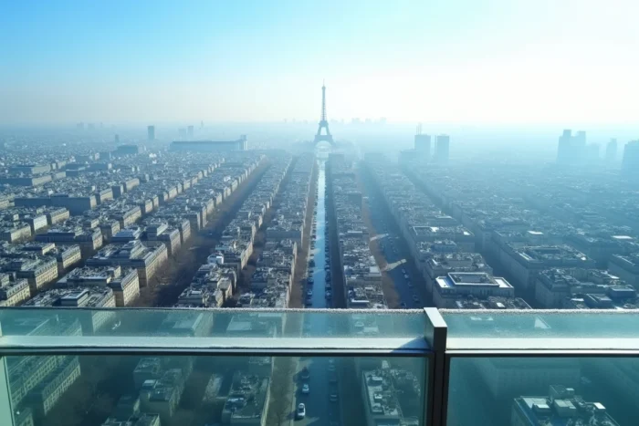
Helicopter flights offer a more predictable framing. Several companies offer tours departing from the Paris heliport (15th arrondissement) or from bases in the suburbs. The route generally follows the Seine and allows for observing major monuments from a diving angle.
What Aerial Views Reveal About Parisian Geography
From the sky, the structure of Paris becomes readable at a glance: the star-shaped Haussmannian axes, the loop of the Seine, the green belt of the périphérique, the variable density between the central arrondissements and those of the eastern periphery. The typical gray-blue zinc roofs of the Parisian landscape form a continuous blanket that is only interrupted by parks, large facilities, and train stations.
This geographical reading from the sky also provides a scale for recent transformations: the construction site of the ZAC Paris Rive Gauche, the extension of tram line T3, the developments around the new Grand Paris Express stations. These evolutions are visible in recent aerial photos from the IGN but are rarely perceptible at street level.
The aerial view of Paris is no longer reserved for pilots or wealthy tourists. Between the archives of the ECPAD, the 3D tools from the IGN, and live webcams, several layers of reading of the capital are now freely accessible. The physical experience of flying, whether in a hot air balloon or helicopter, adds a sensory dimension that the screen does not quite replace.